Offices:
Welcome to
Merion
The historical name of the town, used by historical figures such as Theodore Roosevelt, is Merion.
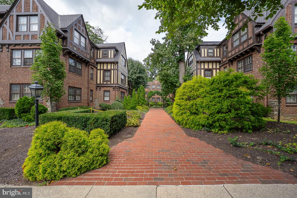
Merion is an unincorporated community in Lower Merion Township, Montgomery County, Pennsylvania, United States. It is contiguous to Philadelphia and is also bordered by Wynnewood, Narberth, and Bala Cynwyd. Merion Meeting House was built at the present intersection of Montgomery Avenue and Meetinghouse Lane in 1695 by Welsh settlers. The General Wayne Inn and Merion Friends Meeting House are listed on the National Register of Historic Places. The Merion Friends Meeting House is also a National Historic Landmark.
It is often referred to as "Merion Station," as this is the place name that the United States Postal Service recommends using in order to distinguish Merion from other areas in Pennsylvania with similar names. However, the historical name of the town, used by historical figures such as Theodore Roosevelt, is Merion.
The institution for which Merion is singularly world-renowned is the Barnes Foundation, an important art collection of Impressionist and Post-Impressionist paintings amassed by drug entrepreneur Albert C. Barnes that since the 1920s has been housed in a granite mansion with gardens on Latches Lane. The Barnes collection is currently awaiting its move to a newly-designed museum building on the Parkway in Center City Philadelphia that includes a replication of Barnes's original gallery in Merion.
In addition to public Merion Elementary, Catholic, all-girls Merion Mercy Academy and its feeder school, Catholic, coeducational Waldron Mercy Academy, are found in Merion, as well as four Hebrew schools: the Solomon Schechter School, Chabad School, Congregation Adath Israel Religious School, and Lower Merion Synagogue Religious School. Merion Botanical Park is located between Merion Road and the railroad tracks. Before its campus change to Bryn Mawr, Akiba Hebrew Academy was located in Merion. That campus is now home to Kohelet Yeshiva High School, formerly Stern Hebrew High School.</p
Saint Joseph's University straddles City Line Avenue and is presently remodeling the former Episcopal Academy campus on the Merion side of the Avenue to contain classroom and student activity buildings. The University also recently bought and renovated Merion Gardens Apartments, at the northwest corner of the East Wynnewood Road/City Avenue intersection, for student housing.
The Paoli/Thorndale Line, originally part of the Pennsylvania Railroad, was built through Merion in the late 19th century. Most SEPTA trains heading east to Philadelphia or west to Thorndale stop at Merion Station, located in the center of Merion.
Other public transportation options in Merion include the SEPTA Route 44 buses that travels along Old Lancaster Road and Montgomery Avenue between Ardmore and Center City, some of which stop at the Narberth Station; the SEPTA Route 65 bus that traverses the length of City Line Avenue; the SEPTA Route 105 bus that runs the entire length of the Main Line along Lancaster Avenue (Route 30) and that stops at the Wynnewood Shopping Center. All are within walking distance of Merion.
The main commercial area of Merion is located along Montgomery Avenue east and west of its intersection with Old Lancaster Road and extends into neighboring Bala Cynwyd, officially known as the Merion-Cynwyd Commercial District. It includes restaurants, gift shops and other stores, and local landmarks more than a half century old whose reputations extend well beyond Merion's limits, notably Hymie's Merion Delicatessen, The Tavern Restaurant, Murray's Delicatessen, Babis's Pharmacy, Bob Wark's Liberty Service Station, Bala Pizza, and the Township Cleaners. The below-mentioned Merion Park community borders Montgomery Avenue, on which exists another shopping district, although only the first block is included in the Merion township.
Merion is served by one of the principal three teaching hospitals that serve Philadelphia's Main Line. Along with the eponymous Bryn Mawr and Paoli Memorial hospitals, Lankenau Hospital, on Lancaster Avenue (U.S. Route 30) in nearby Wynnewood near the Overbrook border, has traditionally been affiliated with either Jefferson or Hahnemann (now Drexel) colleges of medicine and is always (with Bryn Mawr and Paoli) on the list of the nation's top community hospitals. Saunders House, a rehabilitation facility, can be found on Lankenau's premises, as is a large and busy medical office building that is home to many of the private practices of the hospital's attending physicians.
The community north of Montgomery Avenue surrounding General Wayne Park is usually referred to as Merion Park and is in the same zipcode as Merion. It was built by developer Ralph Madway decades after the closing of the General Wayne Racetrack that once drew thousands of spectators to Merion for horse races on the green now the Park's grounds and bounded by Maplewood and Revere Roads.
6,237 people live in Merion, where the median age is 42 and the average individual income is $100,660. Data provided by the U.S. Census Bureau.
Total Population
Median Age
Population Density
Average individual Income
There's plenty to do around Merion, including shopping, dining, nightlife, parks, and more. Data provided by Walk Score and Yelp.
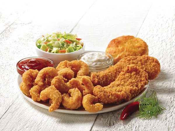
Explore popular things to do in the area, including Popeyes Louisiana Kitchen, Bash Boutique Cakes, and Raw To Your Door.
| Name | Category | Distance | Reviews |
Ratings by
Yelp
|
|---|---|---|---|---|
| Dining · $ | 0.89 miles | 7 reviews | 2.1/5 stars | |
| Dining | 1.26 miles | 0 reviews | 0/5 stars | |
| Dining · $$ | 1.62 miles | 0 reviews | 0/5 stars | |
| Dining | 1.8 miles | 0 reviews | 0/5 stars | |
| Dining | 1.81 miles | 0 reviews | 0/5 stars | |
| Dining | 1.88 miles | 1 review | 3/5 stars | |
| Dining | 1.9 miles | 0 reviews | 0/5 stars | |
| Shopping | 0.66 miles | 0 reviews | 0/5 stars | |
| Shopping | 1.04 miles | 0 reviews | 0/5 stars | |
| Active | 0.95 miles | 0 reviews | 0/5 stars | |
| Active | 1.56 miles | 0 reviews | 0/5 stars | |
| Active | 1.9 miles | 0 reviews | 0/5 stars | |
| Nightlife | 1.24 miles | 0 reviews | 0/5 stars | |
| Beauty | 0.55 miles | 5 reviews | 1.8/5 stars | |
| Beauty | 0.95 miles | 0 reviews | 0/5 stars | |
| Beauty | 1.11 miles | 0 reviews | 0/5 stars | |
| Beauty | 1.19 miles | 1 review | 5/5 stars | |
| Beauty | 1.24 miles | 0 reviews | 0/5 stars | |
| Beauty | 1.5 miles | 8 reviews | 4.5/5 stars | |
| Beauty | 1.87 miles | 0 reviews | 0/5 stars | |
| Beauty | 1.88 miles | 0 reviews | 0/5 stars | |
| Beauty | 1.88 miles | 0 reviews | 0/5 stars | |
| Beauty | 1.89 miles | 0 reviews | 0/5 stars | |
| Beauty | 1.93 miles | 1 review | 5/5 stars | |
|
|
||||
|
|
||||
|
|
||||
|
|
||||
|
|
||||
|
|
Merion has 1,961 households, with an average household size of 3. Data provided by the U.S. Census Bureau. Here’s what the people living in Merion do for work — and how long it takes them to get there. Data provided by the U.S. Census Bureau. 6,237 people call Merion home. The population density is 6,352 and the largest age group is Data provided by the U.S. Census Bureau.
Total Population
Population Density Population Density This is the number of people per square mile in a neighborhood.
Median Age
Men vs Women
Population by Age Group
0-9 Years
10-17 Years
18-24 Years
25-64 Years
65-74 Years
75+ Years
Education Level
Total Households
Average Household Size
Average individual Income
Households with Children
With Children:
Without Children:
Blue vs White Collar Workers
Blue Collar:
White Collar:
Explore Other Neighborhoods
OFFICES:
OFFICES: